From the community of Crawford Bay on the east shore of Kootenay Lake, find the waste transfer station, follow the road past this (pavement ends at this point) for 1.8km.
Just before this point (150 m), you will find a rusty-colored rock quarry on the left. It is an active quarry; we suggest not parking in this area
There will be a large hump of earth on the right the path starts on the right side of this. The path is fairly easy to follow with some markers in place. There are many slippery spots when wet; good hiking boots are highly recommended.
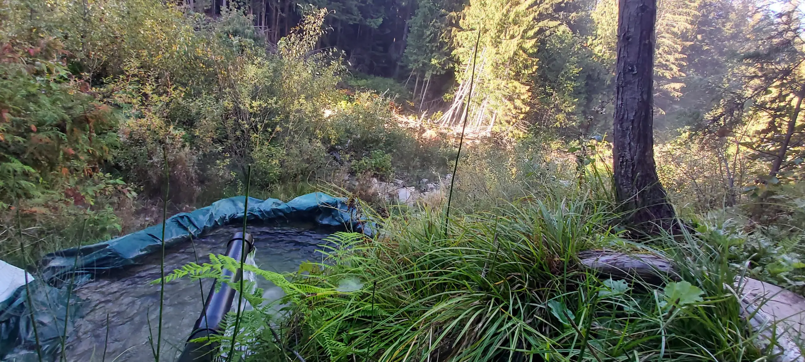
Once at the springs (less than a 15 min steep-ish hike you’ll find a 10x 5 tub built into the ground. The source is a few feet above the pool. Some light plumbing has recently been done to bring the water down, as well as a tarp liner to hold in the water. A valve is set in an outflow pipe to allow draining and cleaning.
The water at the source is about 30 degrees. The water is very clear and noted to be very high in minerals. The remains of an old stove and copper tubing used to heat the water can be seen, but are not in place or active any longer.
The geothermal story behind Crawford Creek Warm Springs
Most hot springs pages stop at “here’s the water, here’s the road.” Crawford Creek is different because it sits right on top of something researchers keep circling back to: a low-temperature geothermal system that might be useful for direct heat (think district heating, greenhouses, process heat), not necessarily electricity.
That’s why the Kootenay Lake Geothermal Project exists. Geoscience BC organized the work in phases and spent real effort comparing multiple areas along the east shore. The headline for locals is simple: they narrowed in on Crawford Creek as the best target for detailed study.
Why this creek, specifically?
Crawford Creek Warm Springs is hosted in the Hamill Formation quartzite. Quartzite itself isn’t magic, but it matters because when it’s fractured, it can move water. The project repeatedly points to the nearby Orebin Creek Fault as a key feature — faults and fracture zones are often the plumbing that lets deeper, warmer water rise toward the surface.
At the surface, the warm spring is often cited at around 32°C. That number doesn’t sound dramatic, but surface temperature is not the same thing as the temperature at depth. Surface springs are frequently cooled by mixing (with creek water, shallow groundwater, and seasonal runoff) before you ever measure them.
What the research team is really trying to answer is: How warm is the water down below, and is there enough permeability + flow to use it for heat?
What Phase 2 did, and why it pointed to Crawford Creek
Phase 2 was the broad comparison stage. This is where they were deciding, “Which site deserves the expensive, detailed work?” In Phase 2 reporting, the Crawford Creek / Orebin Creek area comes up as the strongest candidate, largely because the geology and structure suggest a realistic pathway for thermal fluids.
Phase 2 also sets the stage for how they interpret later data: not as one single “hot pocket,” but as a system where structure (faults/fractures) + rock type + groundwater circulation control, where warm water shows up at the surface.
Phase 3 (centered on Crawford Creek) is where they started collecting enough evidence to build a 3D geological + geothermal model.
Geoscience BC’s Phase 3 reporting says the work continues to support the idea that the system could access geothermal fluids above 75°C, and the CEGA technical abstract goes a step further by discussing a preliminary temperature range of ~75–85°C (or greater) depending on circulation depth and interpretation.
That temperature range is a big deal for one specific reason: it’s squarely in the category of low-enthalpy geothermal, which is often most practical for direct-use heat (heating buildings, greenhouses, hot water loops, industrial heat loads) rather than power generation.
The “what did they actually do out there?” part (the good stuff)
1) Thermal Infrared drone work (TIR)
They flew thermal infrared surveys and highlighted thermal features extending roughly 400 m along the valley bottom. That doesn’t mean “a 400 m long hot tub.” It means they could see temperature anomalies that suggest thermal water is influencing parts of the valley bottom beyond one single vent.
Follow-up work then confirmed additional thermal spring locations beyond the known warm spring. That’s important because multiple discharge points can indicate a broader fracture/flow zone rather than a single isolated seep.
2) ERT (Electrical Resistivity Tomography)
ERT is one of the best “useful in plain English” methods: it helps identify subsurface zones that are more electrically conductive, which can correlate with water saturation, clay alteration, or certain structures. They ran ERT lines and reported conductive features, including signals near the Orebin Creek Fault area that fit their structural model.
ERT doesn’t prove “hot reservoir here,” but it helps narrow where the subsurface plumbing might be, which matters a lot when you start talking about any future test drilling.
3) UAV magnetometer survey
They also used a UAV magnetometer survey to help map structures/lineaments. In their interpretation, the warm spring sits where key mapped features intersect — basically a “fracture crossroads,” which is exactly the kind of place warm groundwater tends to find a route upward.
4) Geochemistry + isotopes (the part most people skip, but it’s the backbone)
This is where things get more reliable than “that rock looks fractured.”
Their technical summary discusses major ions and multiple isotope systems to understand whether the warm spring water looks like:
deep, older thermal water,
shallow local groundwater, or
a mixture of the two.
That mixing question matters because it explains why surface springs can feel “warm but not hot” while still being fed by hotter water at depth.
What does the “2–3 km circulation depth” idea mean in real terms
The CEGA abstract frames the preliminary model as a shallow-circulation geothermal system (they discuss ~2–3 km depth). That’s not a small number — 2–3 km of circulation through fractured rock is exactly how you can end up with a consistent warm spring and still have potentially higher temperatures at depth.
It also implies something important for locals: the “resource” here (if it becomes one) is more likely to be direct heat than a giant electricity plant. Direct-use geothermal is usually less visually disruptive, and it can be scaled for community or industrial needs in ways that power generation often can’t.
2024–2025: where the project’s public story goes next
In 2024, Geoscience BC published Phase 3 results and framed the work as a step toward practical geothermal heat opportunities around Kootenay Lake.
In 2025, public updates start to read less like “collecting data” and more like “what would it take to move this forward?”—including references to financial planning and additional surveying work (including ERT) aimed at narrowing future test/drilling targets.
It’s worth saying, none of this automatically means drilling is imminent, and it definitely doesn’t mean development is guaranteed. But it does mean Crawford Creek is no longer “a random local warm spring.” It’s a mapped target with a growing technical record behind it.
This card is available in MultiWeather Pro. Please upgrade to unlock it.